
Tabula Peutingeriana: Huge Ancient Roman Map Created By Unknown Cartographer
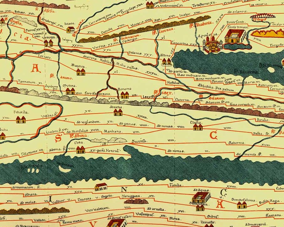
A. Sutherland - AncientPages.com - The Tabula Peutingeriana is a huge, six-meter-long parchment scroll depicting the Roman Empire's road network. It is an ancient, illustrated Roman road map and the only Roman world map that survived from antiquity.
The Tabula Peutingeriana has been used since at least the 18th century as a primary source for geography of the Roman Empire.

Tabula Peutingeriana (section)—top to bottom: Dalmatian coast, Adriatic Sea, southern Italy, Sicily, African Mediterranean coast. Image credit: Wikipedia
The map also known as “Peutinger Map” is a priceless artifact that has been dated to the twelfth or thirteenth century, but historians are convinced this is a copy of a much older original. The unknown cartographer used older sources, which date back to the first century.
A unique copy of the map is currently preserved at the National Library in Vienna. The map was discovered in a library in Worms by Conrad Celtes, who was unable to publish his find before his death and donated the map in 1508 to Konrad Peutinger, a German 15–16th-century humanist and antiquarian, after whom it is named.
It was passed around royal and elite families until it was bought by Prince Eugene of Savoy, and upon his death it was purchased by Vienna’s Austrian National Library where it has been kept since 1737.
According to one theory, the existing Tabula Peutingeriana is based on a document dated to the 4th or 5th century that contained a copy of the world map originally prepared by Marcus Vipsanius Agrippa, a Roman general, architect, and friend of Emperor Augustus (27 BC – AD 14).
Tabula Peutingeriana (section V - source
After Agrippa's death in 12 BC, that map was engraved in marble and placed in the Porticus Vipsania in the Campus Agrippae area in Rome, close to the Ara Pacis building.
However, Emily Albu, Professor Emerita of Classics University of Virginia, has suggested that the existing map could instead be based on an original from the Carolingian period that occurred from the late 8th century to the 9th century
Tabula Peutingeriana covers Europe (without the Iberian Peninsula and the British Isles), North Africa, and parts of Asia, including the Middle East, Persia, and India and the Ganges River, Sri Lanka (Insula Taprobane), even an indication of China.
The map also shows many Roman settlements, the roads connecting them, rivers, mountains, forests and seas. Three most important cities of the Roman Empire, Rome, Constantinople and Antioch, are represented with special iconic decoration.
The distances between the settlements showed on the map are also given and marked in Roman numerals indicating the miles or Gallic league (an ancient measurement, the original of the Old English mile).
Today this unique map is in very fragile condition. It was displayed to the public for a single day on November 26, 2007.
The full map with all details is shown - here.
Written by – A. Sutherland - AncientPages.com Senior Staff Writer
Updated on January 21, 2024
Copyright © AncientPages.com All rights reserved. This material may not be published, broadcast, rewritten or redistributed in whole or part without the express written permission of AncientPages.com
Expand for referencesReferences:
More From Ancient Pages
-
 Unique Codex Cospi: Pre-Columbian Manuscript Will Soon Reveal Some Of Its Secrets
-
 Tikal Of Maya: Sophisticated Culture That Experienced Humble Start, Golden Age, Wars And Decline
-
 Did The Viking Blood Eagle Ritual Ever Happen Or Was It A Misunderstood Story?
-
 Zep Tepi – When Gods Established Their Kingdom On Earth In Egypt
-
 Neanderthals Decorated Their Caves With Rocks 130,000 Years Ago – Find At Krapina Site Reveals
-
 Hidden Details Discovered In Picasso’s Painting The Crouching Woman
-
 Glooskap (Gluskap): Mythical Hero Who Defeated Evil Sorcerers And Demon Followers
-
 80,000-Year-Old Bone Tools Discovered In South Africa Sheds New Light How Homo Sapiens Evolved
-
 Mysterious Great Dismal Swamp – Why Can No One Find The Cemetery Twice?
-
 Heyoka – Sacred Clown Who By Doing The Opposite Helps And Guides In Daily Life
-
 Unexplained Case Of Ancient Authors Who Foretold One Of the World’s Greatest Catastrophes
-
 Mysterious Disappearance Of Explorer Peng Jiamu In Lop Nur – The Wandering Lake
-
 Excavations Reveal New Artifacts That Change History Of Ancient City Of Pergamon
-
 Mysterious Advanced Underground Civilization And A Secret Society – Astonishing Discovery And Connection – Part 1
-
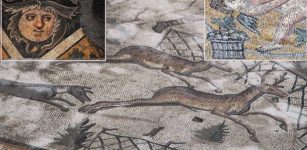 Beautiful Mosaics In Ancient City Of Germanicia
-
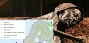 1,000 Bog Bodies From Across Scandinavia Reveal More Ancient Secrets – Here’s What Scientists Found
-
 Why Are Statues Of Mythical Yeti Dividing People In The Himalayas?
-
 Munkholmen: Island With Intriguing Yet Dark And Scary History
-
 Ancient King Who Built A Mysterious Underground City Illuminated By Artificial Lights As Hiding Place
-
 Death And Afterlife In Sumerian Beliefs