


Mt Tarawera’s 1886 eruption was the largest New Zealand has seen in 700 years. It destroyed the pink and white terraces and claimed more than 150 lives, but its ferocity also created incredible geothermal features.
On a winter’s night in 1886, the earth ripped in two.
The sleeping menace of Mt Tarawera had finally awoken, and it meant business.
The sound of its almighty bellow was heard in Auckland – its smoke seen in Christchurch.
People in Rotorua thought the world was ending.
“Every man, woman and child thought their end had come. The sensation was fearful and indescribable,” an eye witness told The Evening Star.
The scenes sounded apocalyptic – an electrical storm raged overhead, the skies rained fire and boiling springs opened up where previously there were none.
One woman was reportedly swallowed by a hungry mud pit, and several villages were buried in ash and mud.
The official death toll was 153, but some suspect it was much higher due to inaccurate statistics of the Māori population.
The longest-grieved casualty of the eruption was the fabled pink and white terraces, once called the eighth wonder of the world, drowned beneath Lake Rotomahana, which expanded significantly in the eruption’s aftermath.
Once heavily forested, Mt Tarawera was stripped bare, like an open wound, and even now remains only sparsely covered.
Today, it boasts some of New Zealand’s most breathtaking volcanic scenery, but the mountain has been relatively quiet since it was closed to the public by Bay of Plenty iwi Ngāti Rangitihi in a move to protect the taonga from disrespectful visitors.

Ngāti Rangitihi is one of several iwi affiliated to Mt Tarawera and its whakapapa.
It is considered a place of great importance to the iwi, and urupa (burial grounds) – considered tapu – can be found offtrack.
After years of visitor degradation, Ngāti Rangitihi put its foot down in 2002 and closed the maunga.
Until that time, vehicle access had made the craters all too reachable, and visitors left tyre damage and trash strewn across the landscape.
Once closed, Ngāti Rangitihi removed 10 tonnes of rubbish from the craters, and access was limited to guided trips only.
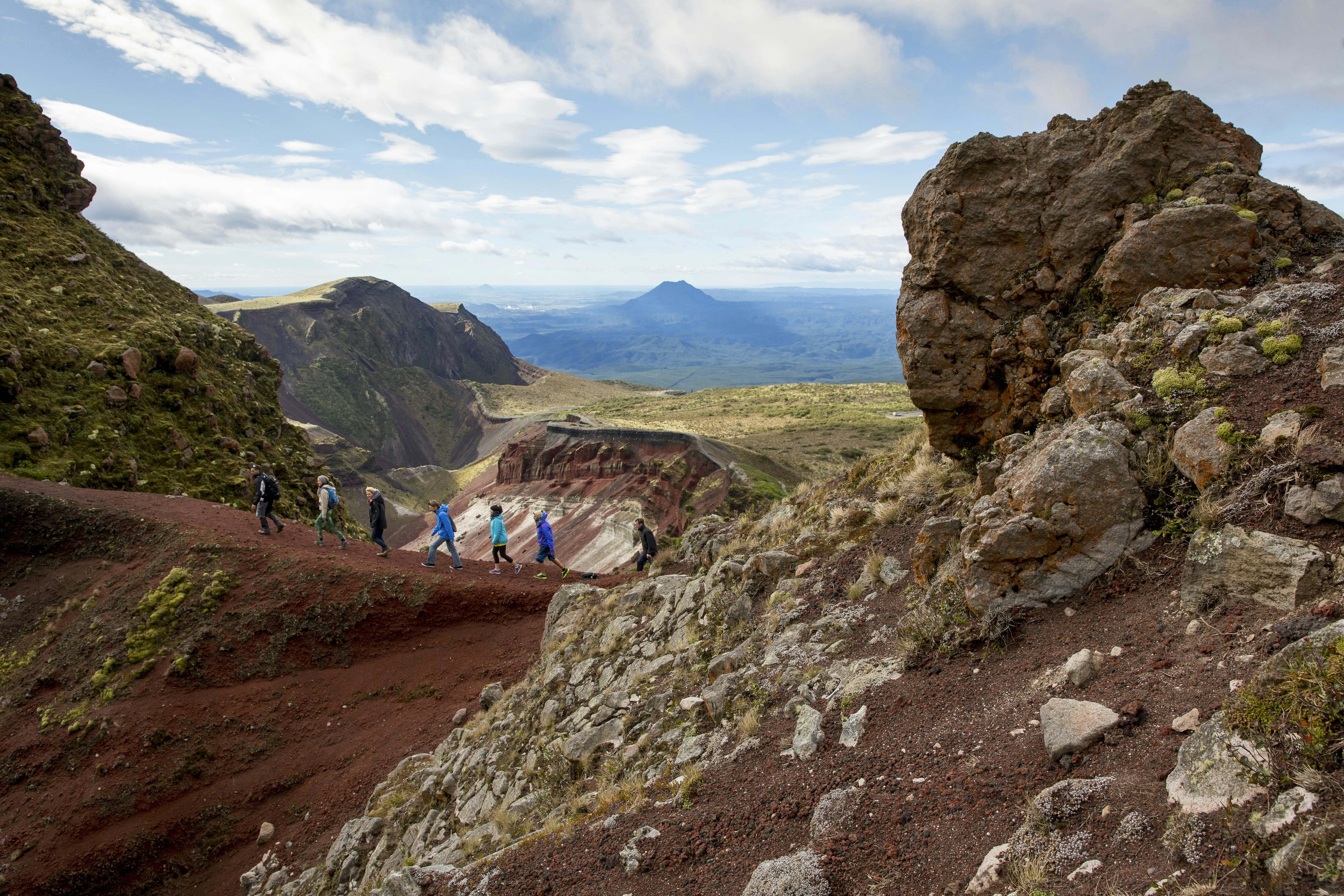
Kaitiaki Adventures currently holds exclusive rights to guided experiences on Mt Tarawera, and save for a few tour groups each day, the volcano sleeps soundly – a far cry from the rat race of Tongariro National Park.
On the morning of my visit, the clouds are low and claustrophobic over Rotorua – more of a threat to visibility than raincoats.
The day before had perfect blue skies our guide, Steve, tells us as our group piles into the transport bus. No such luck today – it’s a whiteout.
The summit road is a nightmare 4WD track through thick scrub – a real joyride on the bus, which bounces along bravely on loose suspension.
It’s barred by locked gates in several places, but it’s almost unnecessary as the rugged road would keep out all but a few vehicles.
By the time we reach the car park, it’s midmorning, but in the whiteout, it could be any time of day.
Steve leads a short karakia, and we set off into the soup.
“It’s one of the only places I know where the rain falls up at you,” Steve says as we climb a windblown ridge, the rain blown defiantly under tightened hoods.
“Some days up here, you’ll be soaked on one side of your body and dry on the other.”
No such luck today. I’m soaked on both sides, and my old waterproof pants are not living up to their name – icy water is soaking down my legs.
The views are incredible, I’m told, stretching as far as White Island in the north-east.
Today, the clag keeps Tarawera’s secrets close to its chest, probably in a ploy to get me to come back.
We follow the crater rim west, and stumble upon the 1111m summit, marked by a sign which looms out of the mist. The views are non-existent today, and we don’t stay long.
We descend a steep scree slope, galloping easily like astronauts in low gravity.
The landscape is similar to Tongariro’s Red Crater – a lunar terrain of bloody crimson soaking scorched earth.
At the bottom, Steve enrols us in the School of Rock, handing around an array of volcanic stones belched into being in 1886.
Some sparkle, some feel leaden in the hand, and each has a different origin story, which Steve explains.
A kārearea overlooks the valley from the steep valley tops – the first living creature I’ve spotted in the desolate red.
It suddenly streaks overhead, pursuing a snack on the wing, and I’ve never seen an animal move so fast.
Both birds round a bend out of sight and although I didn’t see what became of the prey, my gut tells me it regrets its visit to Tarawera.
As we climb out of the crater, the cloud clears at our backs, offering a parting glimpse into the jaws of the earth.
For a moment, Tarawera’s potential is revealed, a watercolour of crimson, ochre and dashing mossy green. I can only imagine how the colours must pop on a blue sky day.
It’s hard to leave a place the weather has hidden, but I don’t doubt I’ll be back to see the stolen views.
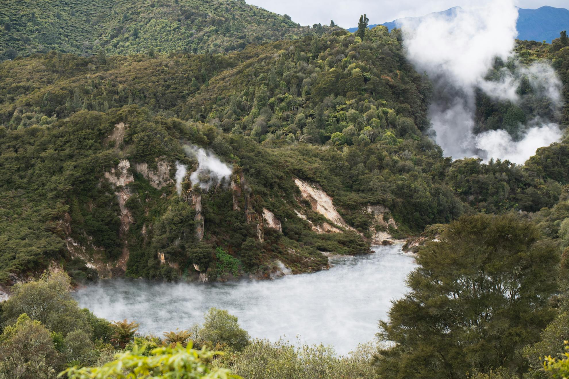
The blast of 1886 opened a 17km rift in the earth. Beginning in the east with the volcano’s three craters, the rift stretches west like a jagged scar, disappearing beneath Lake Rotomahana and continuing from the western shore into Waimangu Volcanic Valley, the world’s youngest geothermal valley.
The eruption completely destroyed the valley’s flora and buried the area in up to 20m of mud and ash. Amongst the destruction, however, new geothermal features sprang into life and by the early 1900s, the area had become a popular tourist attraction.
The now extinct Waimangu Geyser – at the time the most powerful on earth – was its most revered feature.
Sending black water and rock nearly half a kilometre into the air, the geyser erupted regularly and gave Waimangu – meaning black water – its name.
In 1903, four tourists were scalded to death by a forceful eruption, and by 1908 – for reasons unknown – it simply stopped.
Today, the valley is a lush wonderland of regenerating native bush, dotted with vibrant geothermal attractions.
An easy 4km track descends from the Waimangu Volcanic Valley Visitor Centre to the shores of Lake Rotomahana, taking in the highlights of the valley.
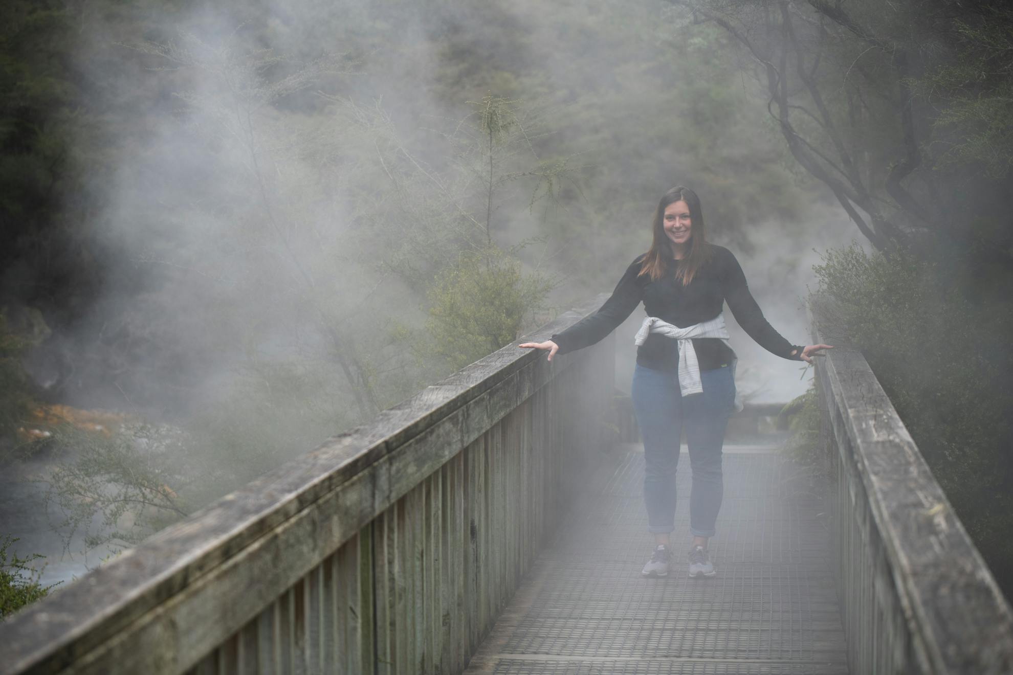
Rotorua is often dubbed Rotovegas for its tourist traffic, but the valley was refreshingly quiet on a fine Sunday afternoon, in part for the fact visitors tend to walk in one direction only, and return by shuttle on a parallel road.
Geothermal wounds smoulder and steam in the distance as the track descends towards Frying Pan Lake, the world’s largest hot spring.
Wispy white steam swirls across its acidic surface, eerie and mesmerising like water on the cusp of the boil, and from here the track follows its steaming outflow all the way to Lake Rotomahana.
Further west breathes the curious Inferno Crater Lake.
It’s the world’s largest geyser-like feature, but its cycle is rather slow – unlike the scheduled Lady Knox Geyser nearby which is induced every morning at 10.30am.
Over 38 days, the lake repeats a complicated cycle which sees its temperature fluctuate between 35 and 80 degrees.
Depending on the day, it can appear a dashing neon blue, a dull grey, or, as on my visit, hidden completely by a whiteout of thick steam.
The water level also fluctuates, reaching an overflow stage – like a slow motion eruption – before the cycle repeats.
From Inferno Crater Lake, walkers can choose between the seldom walked Haszard Hiking Trail and the main route.
The trail will have trampers feeling more at home as it traverses the steep bushline to follow the ridgeline of the crater, before descending to link back with the main trail.
It doesn’t pass any visible geothermal features, but offers impressive views of Mt Tarawera sleeping at the opposite end of Rotomahana.
Keen walkers can tackle both in a loop, but not without some doubling back.
The promise of a shuttle ride back up the hill may entice some to put in the hard yards, but if you’re pressed for time, the main route offers greater geothermal diversity for less effort.
The final 20 minutes of the trail leads through a steaming wetlands teeming with birds, perhaps enjoying the warm waters flowing into Lake Rotomahana.
Visiting both bookends of the volcanic rift is an incredible experience.
One is a sleeping dog, tuckered out from a ferocious bite 130 years ago – the other a lively pup, growing, yapping, and changing almost before your eyes.
What they will look like in years to come is anybody’s guess, but I wouldn’t want to be anywhere near when they next wake up in an explosion of barks.
Mt Tarawera versus Tongariro Alpine Crossing
Mt Tarawera Summit Walk: The summit can only be reached with Kaitiaki Adventures.
The 4.5hr trip costs $164, and includes a return shuttle from Rotorua. The 1111m summit boasts spectacular views of the region, and the 4km track explores the crater and scree slopes.
Guided trips are run year round. Just 45 visitors can be guided on the mountain at a time.
Tongariro Alpine Crossing: The TAC is free to walk, but transport shuttles (required during walking season) range from $35. The 19.4km track is most commonly walked between November and April, and is notoriously dangerous when walked off season or in poor weather. At 1868m, Red Crater is the highest point on the track. In peak season, the track can attract more than 3000 walkers a day.
